
Norgeskart
Programmet er organisert slik at Form1 tar seg av dialogen og holder lister av nødvendige data. Det er laget en egen klasse GeoUnit for å representere hver kommune.
Form
public partial class Form1 : Form
{
    // transformation matrix, set on draw and used on click
    Matrix TM;
    // all polygon points
    List<Point> pntList = new List<Point>(3200);
    // all kommunes, as Kommune-instances
    List<Kommune> kommuner = new List<Kommune>(450);
    // list of fylke (and country=0)
    fylke[] fylkeList;
    // selected fylke (or Norge=0)
    int selectedFylke = 0;
    protected String hilitedName = "";
    protected int hilitedIx = -1;
    protected String clickFoundName = "";
    protected String clickFoundId = "";
    protected int clickFoundIx=-1;
    public Form1()
    {
        InitializeComponent();
        InitializeMap();
    }
    protected void InitializeMap()
    {
        // load necessary data and prepare the datastructure
        // fill up pntList from data in properties
        // and find surrounding rectangle
        String t = Properties.Resources.pnts;
        String[] list = t.Split('\n');
        int MinX = int.MaxValue;
        int MaxX = int.MinValue;
        int MinY = int.MaxValue;
        int MaxY = int.MinValue;
        for (int ix = 0; ix < list.Length; ix++)
        {
            if(list[ix].IndexOf(',')==-1)
                continue;
            Point p =
                new Point(Convert.ToInt32(list[ix].Split(',')[0]),
                          Convert.ToInt32(list[ix].Split(',')[1]));
            if (p.X < MinX) MinX = p.X;
            if (p.X > MaxX) MaxX = p.X;
            if (p.Y < MinY) MinY = p.Y;
            if (p.Y > MaxY) MaxY = p.Y;
            pntList.Add(p);
        }
        fylkeList = new fylke[21];
        // norge as fylke 0
        fylke fy = new fylke();
        fy.id = "00";
        fy.name = "Norge";
        fy.border =
            new Rectangle(MinX, MinY, MaxX - MinX, MaxY - MinY);
        fylkeList[0]=fy;

        // make kommune index
        t = Properties.Resources.kindex;
        list = t.Split('\n');
        for (int ix = 0; ix < list.Length; ix++)
            if (list[ix].Trim().Length > 1)
                kommuner.Add(new Kommune(list[ix],pntList));
        // set up fylker (assume resource fylker sorted)
        String fs = Properties.Resources.fylker;
        String[] flist = fs.Split('\n');
        for (int fix = 1; fix < 21; fix++)
        {
            if (flist[fix-1].IndexOf(':') == -1)
                continue;
            fy = new fylke();
            String s = Convert.ToString(fix);
            if (s.Length == 1)
                s = "0" + s;
            fy.id = s;
            fy.name = flist[fix-1].Split(':')[1].Trim();
            if (fix == 13)// does not exist (was Bergen ?)
                fy.border = new Rectangle(1, 1, 1, 1);
            else
                fy.border = MakeBorder(fy.id);
            fylkeList[fix]=fy;
        }

        // fill combobox for fylke (and country) selection
        for (int cix = 0; cix < fylkeList.Length; cix++)
        {
            if(cix==13)
                continue;
            comboBoxView.Items.Add(fylkeList[cix].name);
        }
        comboBoxView.SelectedIndex = 0;
    }
    // prepare border for a fylker
    protected Rectangle MakeBorder(String id)
    {
        // run kommuneliste and identify borders of actual fylke
        int MinX=int.MaxValue;
        int MaxX=int.MinValue;
        int MinY=int.MaxValue;
        int MaxY=int.MinValue;
        for (int kix = 0; kix < kommuner.Count; kix++)
        {
            Kommune kom = (Kommune)kommuner[kix];
            String kid = kom.Id;
            // is it in correct fylke ?
            if (kid.Substring(0, 2).CompareTo(id)==0)
            {
                Rectangle kR = kom.Border;
                MinX = Math.Min(MinX, kR.Left);
                MinY = Math.Min(MinY, kR.Top);
                MaxX = Math.Max(MaxX, kR.Right);
                MaxY = Math.Max(MaxY, kR.Bottom);
            }
        }
        return new Rectangle(MinX,MinY,MaxX-MinX,MaxY-MinY);
    }
    // draw everything
    public void DrawMap(Graphics g, Rectangle R,Rectangle modelR)
    {
        // do necessary transformation
        g.ResetTransform();
        g.TranslateTransform(-modelR.Left,
                             modelR.Bottom,
                             MatrixOrder.Append);
        g.ScaleTransform(1.0f, -1.0f, MatrixOrder.Prepend);
        float scalefactor =
            0.99f * Math.Min((float)R.Height /
            (float)modelR.Height,
            (float)R.Width / (float)modelR.Width);
        g.ScaleTransform(scalefactor,
            scalefactor,
            MatrixOrder.Append);
        // remember matrix
        TM = g.Transform;

        //transform is set, we draw all kommuner
        for (int ix = 0; ix < kommuner.Count; ix++)
        {
            List<Point> plist = kommuner[ix].Index;
            Point[] polygon = plist.ToArray();
            String kName=kommuner[ix].Name;
            String kId = kommuner[ix].Id;
            if (kName.CompareTo(hilitedName) == 0)
                g.FillPolygon(new SolidBrush(Color.Blue), polygon);
            else if (kName.CompareTo(clickFoundName) == 0)
                g.FillPolygon(new SolidBrush(Color.Red), polygon);
            else if ((kId.Substring(0,2).
                      CompareTo(fylkeList[selectedFylke].id)==0)
                     || (selectedFylke==0))
                g.FillPolygon(new SolidBrush(Color.White), polygon);
            g.DrawPolygon(new Pen(Color.Black), polygon);
        }
    }
    // where have we clicked
    public Boolean FindWhere(int x, int y, Rectangle R,Rectangle modelR)
    {
        // must translate the clickpnt to model coord
        Matrix m = TM.Clone();
        m.Invert();
        Point[] pts = new Point[1] { new Point(x, y) };
        m.TransformPoints(pts);
        int testCount = 0;
        clickFoundName = "None";
        while (testCount++ < kommuner.Count+1)
        for (int kix=0;kix<kommuner.Count;kix++)
        {

            if (kommuner[kix].GetHit(pts[0].X, pts[0].Y))
            {
                clickFoundName = kommuner[kix].Name;
                clickFoundId = kommuner[kix].Id;
                clickFoundIx = kix;
                return true;
            }
        }
        // not hit any kommune
        clickFoundIx = -1;
        return false;
    }
    private void panelMap_Paint(object sender, PaintEventArgs e)
    {
        // paint map
        DrawMap(e.Graphics, panelMap.Bounds,
               fylkeList[selectedFylke].border);
    }
    private void InvalidateKommune(int kix)
    {
        if (kix != -1)
        {
            Rectangle r = kommuner[kix].Border;
            Point[] pts =
                new Point[2] {
                    new Point(r.Left, r.Top),
                    new Point(r.Right, r.Bottom) };
            TM.TransformPoints(pts);
            panelMap.Invalidate(new Rectangle(pts[0],
                new Size(pts[1].X - pts[0].X, pts[1].Y - pts[0].Y)));

        }
    }
    // click on map
    private void panelMap_MouseClick(object sender, MouseEventArgs e)
    {
        // clicked on the map
        // invalidate the one hilited now
        InvalidateKommune(clickFoundIx);
        if (FindWhere(e.X, e.Y, panelMap.Bounds,
            fylkeList[selectedFylke].border))
        {
            labelName.Text = clickFoundId + " : " + clickFoundName;
            Rectangle r = new Rectangle(e.X - 100, e.Y - 100, 200, 200);
            // invalidate the new hilite
            InvalidateKommune(clickFoundIx);
        }
    }
    // click on select button
    private void buttonFind_Click(object sender, EventArgs e)
    {
        // clicked the show button
        InvalidateKommune(hilitedIx);
        String who = textBoxLook.Text;
        hilitedIx = -1;
        if ((who != null)&&(who.Length>1))
        {
            //make start with uppercase
            hilitedName = who.Substring(0, 1).ToUpper() + who.Substring(1);
            hilitedIx = FindKommuneIxByName(who);
        }
        InvalidateKommune(hilitedIx);
    }
    private int FindKommuneIxByName(string kname)
    {
        kname = kname.ToUpper();
        for (int ix = 0; ix < kommuner.Count; ix++)
        {
            string n = kommuner[ix].Name.ToUpper();
            if (n.CompareTo(kname) == 0)
                return ix;
        }
        return -1;
    }
    //change fylke (or Norway)
    private void comboBoxView_SelectedIndexChanged(object sender,
                                                  EventArgs e)
    {

        String name = comboBoxView.SelectedItem.ToString();
        for(int ix=0;ix<fylkeList.Length;ix++)
            if(name.CompareTo(fylkeList[ix].name)==0)
            {
                selectedFylke = ix;
                // invalidate everything
                panelMap.Invalidate();
            }
    }
    private void panelMap_Resize(object sender, EventArgs e)
    {
        panelMap.Invalidate();
    }
Fylker og Norge er beskrevet ved en struct:
struct fylke
{
    public String name;
    public String id;
    public Rectangle border;
}
Kommune
class Kommune
{
    protected String name;  //Halden
    protected String id;    //0101
    List<Point> polypnts;
    protected Rectangle border;
    protected GraphicsPath grapath;

    public Kommune(String line,List<Point> pntList)
    {
        // line is kid:name:pointix,...
        id = line.Split(':')[0];
        if (id.Length == 3)
            id = "0" + id;
        name=line.Split(':')[1];
        String[] ilist = line.Split(':')[2].Split(',');
        polypnts = new List<Point>(ilist.Length);
        int maxx = Int32.MinValue;
        int minx = Int32.MaxValue;
        int maxy = Int32.MinValue;
        int miny = Int32.MaxValue;
        for (int ix = 0; ix < ilist.Length; ix++)
        {
            int v=Convert.ToInt32(ilist[ix]);
            Point p = (Point)pntList[v];
            maxx = Math.Max(p.X,maxx);
            maxy = Math.Max(p.Y,maxy);
            minx = Math.Min(p.X, minx);
            miny = Math.Min(p.Y, miny);
            polypnts.Add(p);
        }
        border =
            new Rectangle(minx, miny, maxx - minx, maxy - miny);
        grapath = new GraphicsPath();
        Point[] Pt = (Point[])polypnts.ToArray();
        grapath.AddPolygon(Pt);
    }
    public List<Point> Index { get { return polypnts; } }
    public Rectangle Border { get { return border; } }
    public String Name { get { return name; } }
    public string Id { get { return id; } }
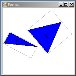
Mekanismen for å sjekke om vi har pekt på en kommune kan lages på mange måter. Vi kan enkelt teste på om et punkt er inne i et rektangel med metoden R.contains(p.X,p.Y), der R er et rektangel og p er et punkt. Videre er det en del rutiner som kan sjekke overlapping av regioner i et grafisk område. Det som er valgt er en allmen, håndskrevet, algoritme for å sjekke om et punkt er inne i et vilkårlig, lukket polygon. Implementasjonen ligger i Geounit:
public Boolean GetHit(int x, int y)
{
    if (!border.Contains(x, y))
        return false;
    return InsidePolygon(x, y);
}
// handmade inside test for polygon
private bool InsidePolygon(int x, int y)
{
    // Returns TRUE if p is inside pol
    // pol can be convex or concave
    // result is not interpretable if pol has crossing lines
    if (polypnts.Count < 3)
        return false;
    // Count intersections to the left of p
    // odd is hit, even is miss
    int pix;
    Point p1 = new Point();
    Point p2 = new Point();
    Point ps = new Point();
    bool Inside = false;
    // close the polygon
    polypnts.Add(polypnts[0]);
    p1.X = border.Left - 10;  // smaller than the smallest
    p1.Y = y;
    p2.X = border.Right + 10;  // bigger than the biggest
    p2.Y = y;
    for (pix = 0; pix < polypnts.Count - 1; pix++)
        if (Intersection(p1, p2, (Point)polypnts[pix],
                        (Point)polypnts[pix + 1], ref ps))
        {
            if (ps.X < x) Inside = !Inside;
        }
    // unclose the polygon
    polypnts.RemoveAt(polypnts.Count - 2);
    return Inside;
}

private bool Intersection(Point p1, Point p2,
                          Point p3, Point p4,
                          ref Point ps)
{
    // finds the intersecton between lines p1-p2 and p3-p4
    // return TRUE if intersection, FALSE else
    // result in ps, if intersection
    int dx1 = p2.X - p1.X;
    int dx2 = p4.X - p3.X;
    int dy1 = p2.Y - p1.Y;
    int dy2 = p4.Y - p3.Y;
    int n = dx2 * dy1 - dy2 * dx1;
    if (n == 0)
        return false;
    double s =
        1.0 * (dx1 * (p3.Y - p1.Y) - dy1 *
        (p3.X - p1.X)) / (1.0 * n);
    if ((s < 0.0) || (s > 1.0))
        return false;
    double t =
        1.0 * (dx2 * (p3.Y - p1.Y) - dy2 *
        (p3.X - p1.X)) / (1.0 * n);
    if ((t < 0.0) || (t > 1.0))
        return false;
    ps.X = (int)(dx1 * t + p1.X);
    ps.Y = (int)(dy1 * t + p1.Y);
    return true;
}
Ut på tur
Prosjektet er bearbeidet litt til en variant der vi kan markere to kommuner og forsøke å finne en vei mellom dem. "Veinettet" er basert på at det går en vei mellom sentrum i to nabokommuner og har altså ikke noe med det reelle verinettrt å gjøre.
Programmet illustrerer en enkel variant av en søkealgoritme.
